Meridian 3
Meridian 3: Coming Soon
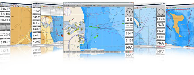
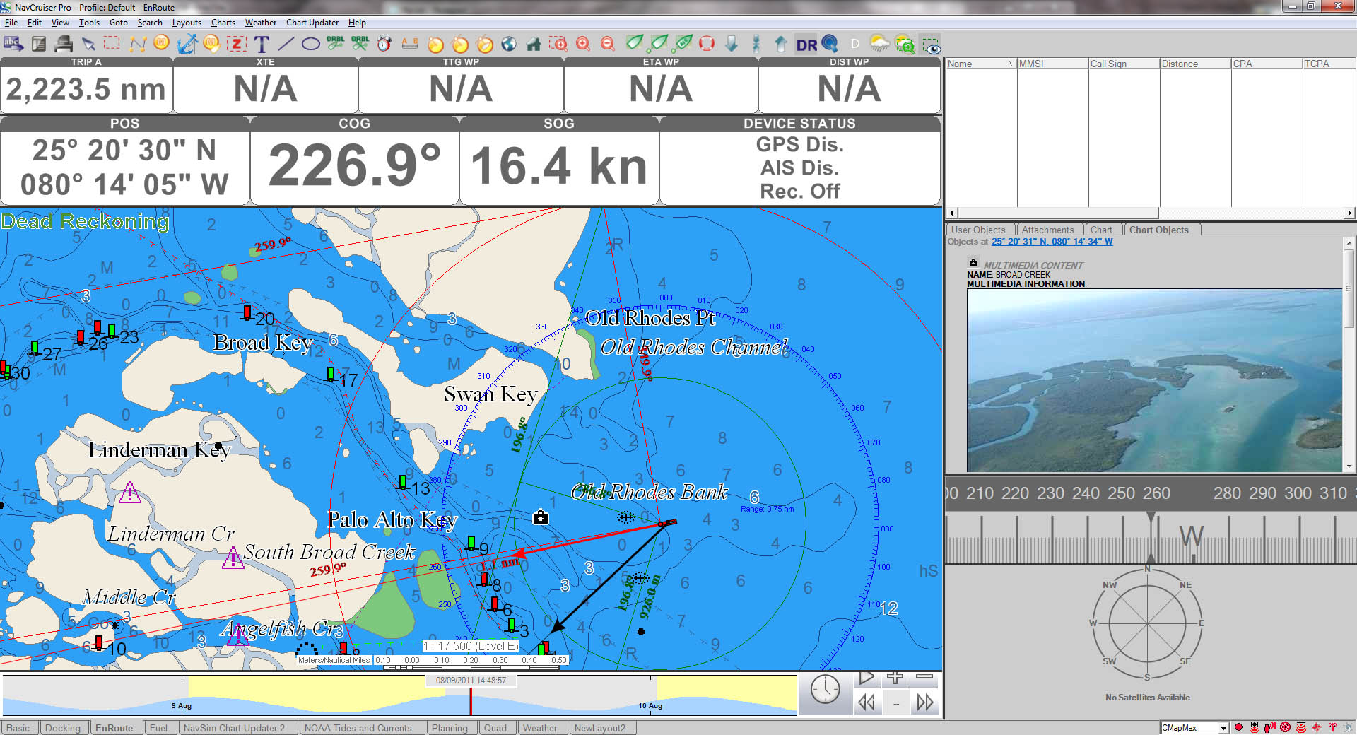
Formerly known as NavCruiser Pro, Meridian is a highly sophisticated marine navigation PC program for the professional mariner. The latest development from NavSim Technology, Meridian includes advanced AIS capabilities including receiving text messages and recording AIS target tracks.

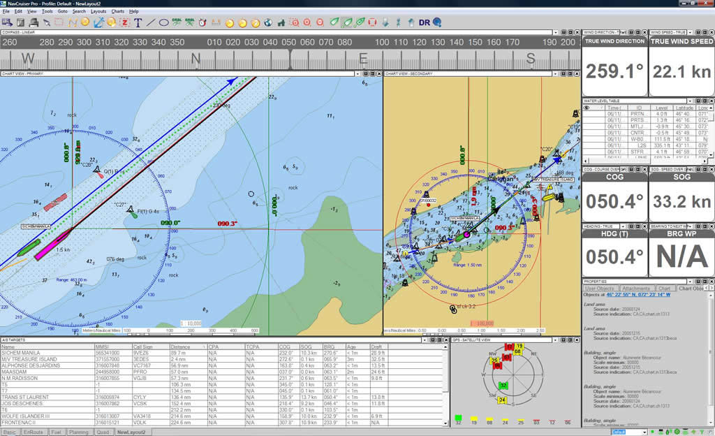
Additional Features such as dual chart view makes Meridian ideal for the serious navigator.
The Meridian package can be customized to include:
- Meridian Software CD-ROM
- Wireless Pilot Plug Adaptor
- C-Map MAX Charts
Meridian Add-On Modules

Add-on modules for Meridian include:
Meridian features include:
- AIS Pilot-Plug Support with quick info display for targets and others
- Multiple Marine Instrument Support including GPS, AIS, Autopilot, ARPA/MARPA and Depth Sounder
- Dual Positioning System
- Custom Screen Layouts
- Split Screen
- Parallel Indexing
- St. Lawrence Seaway AIS Data Messaging
- Fully-custom Max Look-ahead (for C-Map data)
- Fully-configurable Unit System
- Custom Chart-view Modes
- Advanced Hydro-dynamic Vessel Simulation
- Time Machine Feature (Playback, Tide, Current, Sunrise/Sunset)
- Video Camera Support
- C-Map C-Card support
- With C-Map data only: Marinas, Points of Interest, Locations Search
Meridian also contains standard easy-to-use Planning Tools and Powerful Navigation Features such as:
- One-click Unlimited Route Planning
- Course Up, Chart Up, True North and Magnetic North Up Chart Rotation
- Unique Customizable and Re-sizable Screen Displays
- NOAA Tides and Currents for USA territorial waters
- Night, Dusk, and Day Displays
- Zones and Zones Alarms (Entry and/or Exit)
- Man Overboard
- Customizable Markers
- Seamless Chart Quilting
- High-Resolution Chart Printing
- Marinas, Points of Interest and Locations Search
Meridian can be packaged with C-Map MAX charts which contain highly detailed vector information with many dynamic features, including:
- Embedded harbor, inlet and marina photos
- Coastal Roads, land elevations and points of interest
- Tide and Current information
- Flashing NavAids
- Perspective View, providing a forward-looking angle
- C-Marina Charts with highly detailed drawings of marinas, showing docks and facility information
For more information on C-Map MAX charts and features, please refer to the C-Map website.
In addition to C-Map MAX charts, Meridian also supports the following marine Chart formats:
- ENC S-57
- S-63 (Encrypted S-57 – i.e. Primar)
- BSB versions 3, 4, and 5 (available from CHS, NOAA RNC’s, Maptech, Softchart, etc.)
- C-Map MAX Pro
- C-Map NT+
Meridian offers a number of distinct improvements / refinements throughout many areas, but the primary improvements include the following.
Screen Display, Information Presentation and Manipulation
- User Profile Settings: For sensor and chart system configuration and screen layout individual users can now create and save their own unique Profile under which all user settings for the system, as well as all layout screens, are stored. These Profiles can be exported or imported to other systems or users.
- Alarm Management: All Meridian v3 versions of our software have enhanced system alarm management menus featuring quicker access and easier configuration than previous versions. We have also fitted a new anchor watch and alarm function for enhanced safety when at anchorage.
- Sensor Management: Features an improved central sensor menu to activate and configure all incoming sensors to the electronic charting system. V3 also features a NMEA 0183 logger utility which allows the user to directly view and optionally save all incoming NMEA data streams from any and all sensors.
AIS Contact Management
- CLASS A and CLASS B: Features enhanced AIS contact management menus that allow the user to distinguish and sort Class A from Class B contacts for improved situational awareness.
- AIS Quick Info Display: New improved on-screen AIS quick info is semi-transparent to ensure that AIS quick info does not obscure any important information underneath.
- Target Search/Watch: Allows the user to search AIS contacts by vessel name, MMSI, or CallSign.
- Target Count / Underway: Tells the user total AIS targets in view and how many are underway.


